
Bridging cultures, counties and communities

This mile-long bridge is the latest effort to overcome the continental division of the Missouri River. The Missouri River is a transportation corridor and a barrier since before Thomas Jefferson. That’s why he commissioned the Corps of Discovery to learn more about the river.
History

From the North Dakota State Historical Society. The first Four Bears Bridge built near the now-flooded town of Elbowoods.

1940 Four Bears Bridge at Elbowoods. This is about 13 years before the Army Corps of Engineers flooded the valley and moved the bridge. (From the U.S. Geological Survey)
Until about 1925, there was no way to cross the river in this part of the United States. America fought a World War and became a powerhouse in world politics, but travelers still couldn’t cross the Missouri River. Local entrepreneurs ran ferries which could be unreliable and unsafe.
A national lobbying effort prompted Washington to pay for a bridge across the Missouri River. So, engineers chose a spot on Highway 8 south of Stanley in Mountrail County and north of Halliday in Dunn County. It linked the bustling town of Elbowoods to the rest of the nation to the south.
Flooded
In 1950, after the Second World War, the Army Corps of Engineers built a series of dams on the Missouri River including one in Garrison, North Dakota. It was apparent the water behind the dam would cover the original Four Bears Bridge on old Highway 8. So, the government paid to have the original bridge dismantled and moved about 70 miles upstream next to the existing Verendrye Bridge that crossed the Missouri River at the little town of Sanish.

The Four Bears Bridge was dismantled at its original site, trucked to a docking point and then barged to its new home. Crews from as far away as Lake Charles, Louisiana moved to the area to build it to span Lake Sakakawea.
Old Standards
The original bridge was built to 1925 standards with two eight-foot driving lanes, no shoulders, no walkways. Those dimensions were maintained when it was rebuilt. That’s why it was deemed functionally obsolete. 1925 vehicles didn’t need as much room as 2000 vehicles. It was too narrow and too low of clearance In fact, two large farm trucks could not meet on the bridge. If they did, one would have to back off to let the other cross. More than once, truck mirrors were smashed against each other when trucks met on the bridge.
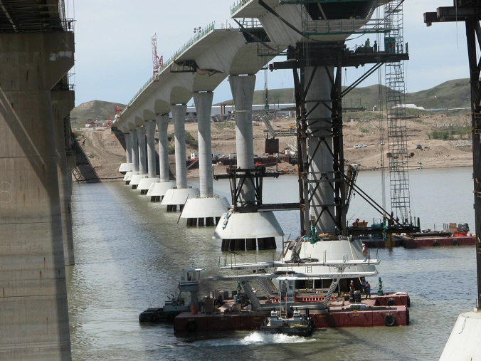
Two construction barges under the old Four Bears Bridge move two precast concrete bridge segments into place to be lifted and attached to the growing structure.
It took four construction seasons, 2003-2007, to build the new $54 million dollar bridge. The design was developed over the course of several years before that. One of the criteria of the design was that it must be built using context-sensitive elements. It had to fit the cultural and natural environment.
The outcome was a huge success. That’s why it has won several international design contests. As a result, it’s been recognized as a model for designing a modern structure that seamlessly fits into the cultural, natural, social and economic environment of the area.

The arches between piers mimic the hills along the river.
Designers incorporated sweeping curves into the bridge to visually replicate the curves of the nearby hills in the Badlands. 
Our Recommendations
Tribal symbols on the bridge wall.
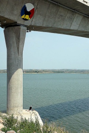
Walk the bridge to see the history in the artwork of the Three Affiliated Tribes of the Fort Berthold Indian Reservation, the MHA Nation. That’s where you’ll see the stories of the Mandan, Hidatsa, and Arikara nations. They are on storyboards on both ends of the bridge. In addition, you’ll walk by tributes to their ancestors along the railing of the walkway. Those tributes are medallions of the cultural history of the Three Affiliated Tribes, their leaders, sacred animals, and historical events. Also, the railing also includes silhouettes of sacred animals, some of which are on emblems below the bridge.
Sit a spell
Benches along the way give you places to sit and absorb the sights and sounds. The concrete trail at the park leads down the riverbank to observation points below and alongside the bridge. From here you can clearly see the medicine wheel on the opposite hillside. This ancient sacred place accurately points the four cardinal directions.
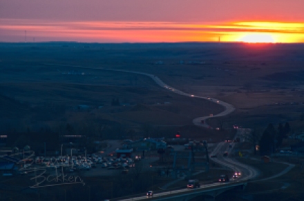
Looking over McKenzie County from Crow Flies High, on the east end of the bridge, it’s apparent Highway 23 wanders and snakes across the hills toward the Four Bears Bridge.
Crow Flies High
On the east side of the bridge, the Mountrail County side, drive to the maintained historical site above the medicine wheel. The point is called Crows High or Crow Flies High and includes storyboards of Native American history. Look over the edge of the parking area to the north, straight down is what remains of the flooded town of Sanish. When the lake level is low, many of the foundations are visible.
Click here to read how the new bridge was built
How to get there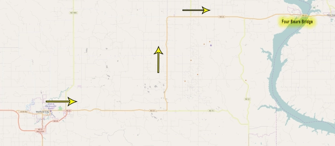
Head east from Watford City on Highway 23 about 40 miles to the far eastern border of McKenzie County. There can be a fair amount of truck traffic on the road, but don’t get in a hurry. Many passing lanes help you go around slow traffic between Watford City and New Town.
On the opposite side of McKenzie County is a much different transportation monument — the incredible Cartwright Tunnel and Fairview Liftbridge.


That’s one reason McKenzie County is one of our favorite destinations in the North Dakota Badlands. You’ll see why when you subscribe to this blog. You’ll get first notice of a new article in your inbox. Just tell us where to send it. No spam!
We share much much more information from all sources that relate to the Beautiful Badlands on our Facebook Page. So, follow us to stay up to date. That’s where you’ll find the popular Things to Do Calendar. It’s here on this website and is a huge asset to anyone looking for things to do and places to go. You can see it here.
